Maps that drive your decisions
Studies, maps and databases produced in France and West Africa since 2018: self-employed since April 2026, previously as an employee, intern or research fellow.
Studies, maps and databases produced in France and West Africa since 2018: self-employed since April 2026, previously as an employee, intern or research fellow.
First GPS field surveys: the 7 bus lines of Saint-Louis, Senegal, as an intern at Géomatica.
Humanitarian mapping projects for HOT, on Tasking Manager and MapSwipe.
Co-author of two chapters in a book published by Springer.
Bernis pilot study: 13 public car parks and 361 spaces checked against the flood risk prevention plan.
Loading projects...
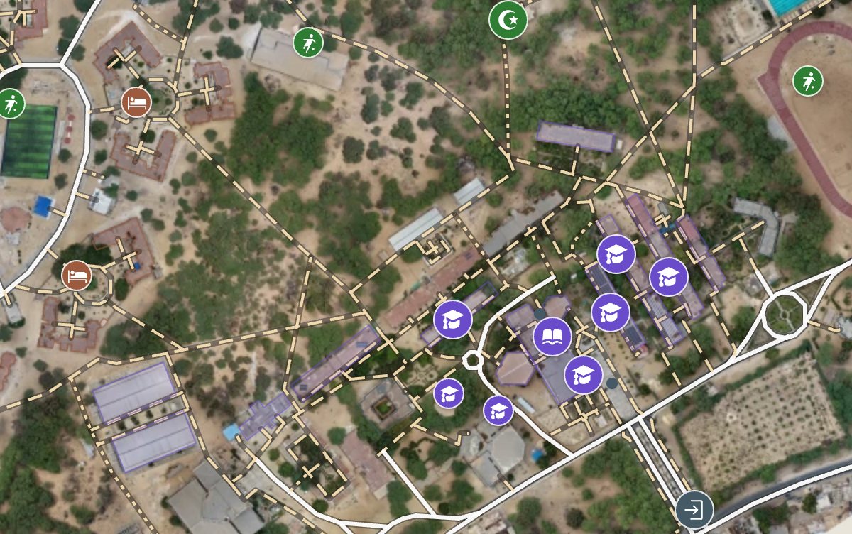
Finding a lecture hall, a faculty or a residence block on the Gaston Berger University campus is hard for a new student. The campus was covered in 3,199 aerial photos, stitched with OpenDroneMap into a 3 cm per pixel orthophoto processed in 15 aligned sectors. Every feature was then digitised in QGIS: 257 buildings, 17 residence villages, the roads and 30.0 km of footpaths. The 150 places are named and classified, and 107 have their entrances mapped, so walking directions lead to the right door, with voice guidance. The map is published as a lightweight web app that installs on a phone and works offline after a first visit.
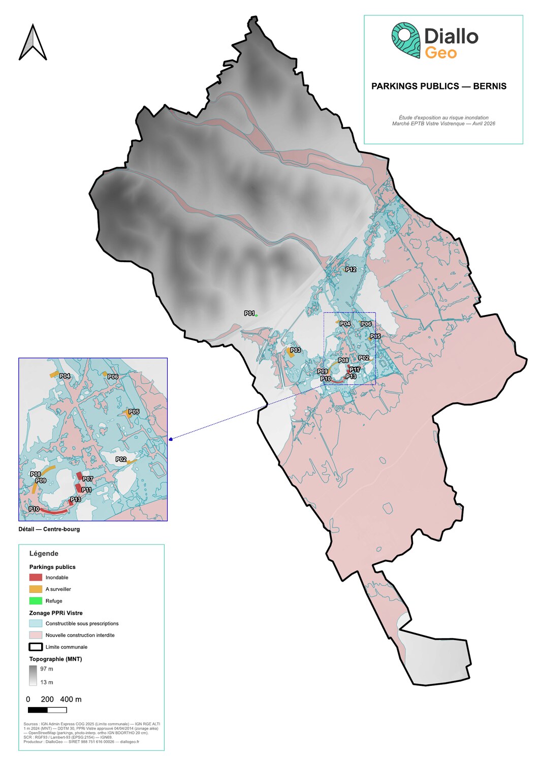
Self-produced pilot study by DialloGeo demonstrating a reproducible GIS methodology to analyse flood risk exposure of public parking areas. Test case: municipality of Bernis (Gard, southern France, 3,425 inhabitants), located in the alluvial plain of the Vistre river basin. Five-phase methodology: - Open data acquisition: IGN Admin Express COG (administrative boundaries), RGE ALTI 1 m DEM, Vistre Flood Prevention Plan (PPRi) from DDTM 30, OpenStreetMap (Overpass API) - GIS preparation: harmonisation in EPSG:2154 (Lambert-93), virtual raster mosaic, DEM clipping, PPRi spatial filtering - Parking inventory: OSM extraction + systematic photo-interpretation on IGN BDORTHO 20 cm aerial imagery + Mapillary validation - Spatial analysis: parking × PPRi spatial join, NGF elevation extraction from DEM, automated three-class classification - Deliverables: A3 portrait map with town centre inset, action sheet for the most exposed parking, enriched GIS layer, reproducible QGIS project Key findings on Bernis: - 13 public parkings identified (4 from OSM + 9 from photo-interpretation) - 361 parking spaces over 12,948 m² of public parking surface - 97% of spaces located within PPRi flood hazard zones - 22% in high hazard zone (4 floodable parkings) - Only 3% in confirmed refuge zone Tools used: QGIS 3.44 — GDAL — Python pyproj — IGN Géoplateforme — Mapillary Data sources: IGN (Admin Express, RGE ALTI 1m DEM, BDORTHO orthophotos), DDTM 30 (Vistre PPRi flood hazard zoning), OpenStreetMap contributors (ODbL).
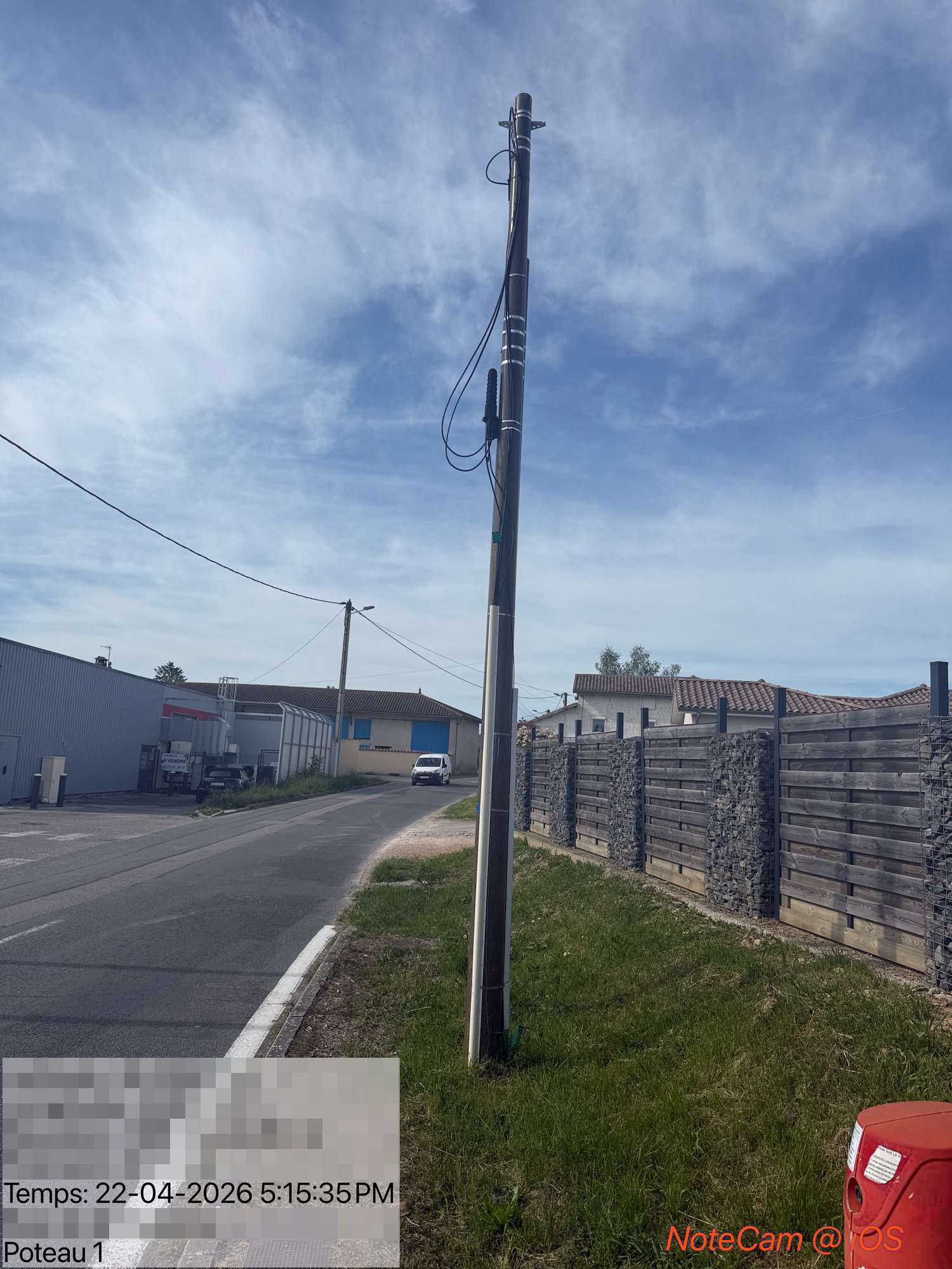
Field mission for Cert-Énergie: 12 feasibility studies on telecom and electrical network infrastructure across 11 municipalities in Saône-et-Loire (71) and Ain (01), France. Varied interventions: pole displacement and replacement, FT/FO bracket and crossarm removal, network connections, SYDESL public lighting survey, Enedis low-voltage reinforcement. Optimized field tour completed in 48 hours (2 days, ~700 km). 11 technical reports delivered with georeferenced photo protocol (6+ photos per pole, active network identification, access measurements, constraints analysis). Work ordered by: Orange, SYDESL, Enedis, EPF Ain.

Full cartographic production for fiber optic (FTTx) deployment in the Haut-Doubs region, France. Splice plans (BPE), cable dimensioning, field quality control, and PostgreSQL/PostGIS database updates using IPON, Geofibre and NetGeo platforms. Over 6 months of continuous production with deliverables meeting operator specifications.
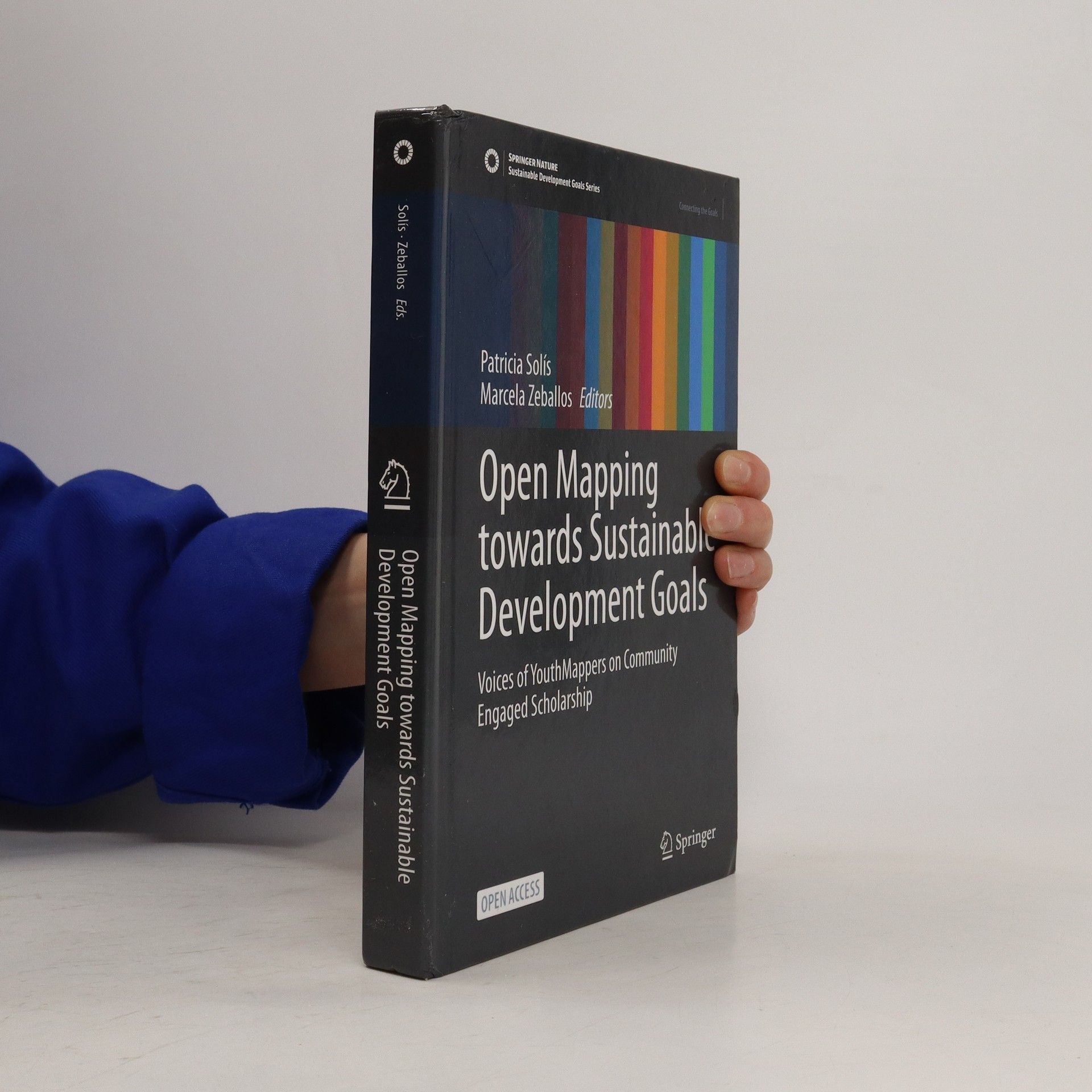
Co-author of Chapter 6 "Cross-Continental YouthMappers Action to Fight Schistosomiasis Transmission in Senegal" published by Springer (2023). Cross-continental collaboration within the MASTR-SLS project (Politecnico di Milano) between Italy, Senegal (UGB YouthMappers), and AIMS (M'Bour) to map schistosomiasis risk areas in the Senegal River valley. Field data collection, OSM mapping of vulnerable villages, and multispectral drone imagery to identify vector habitats. SDGs 3 (health) and 6 (water).

Creation and management of humanitarian mapping projects via Tasking Manager and MapSwipe for HOT's West Africa hub. Quality validation of OpenStreetMap contributions using JOSM, FR↔EN technical documentation translation, and coordination with local volunteer mapping communities.
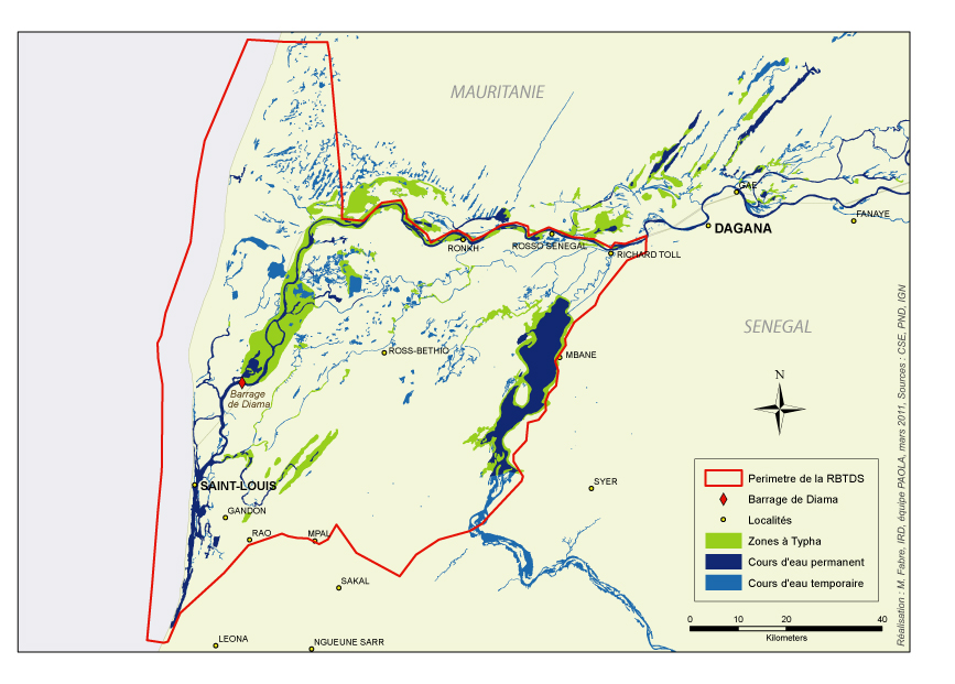
Administration of the SIRENA server, a participatory GIS for the Senegal River delta hosted at Gaston Berger University. PostgreSQL database restoration, bilingual metadata cataloging (FR/EN), and thematic map production for IRD and LEIDI laboratory scientific publications.
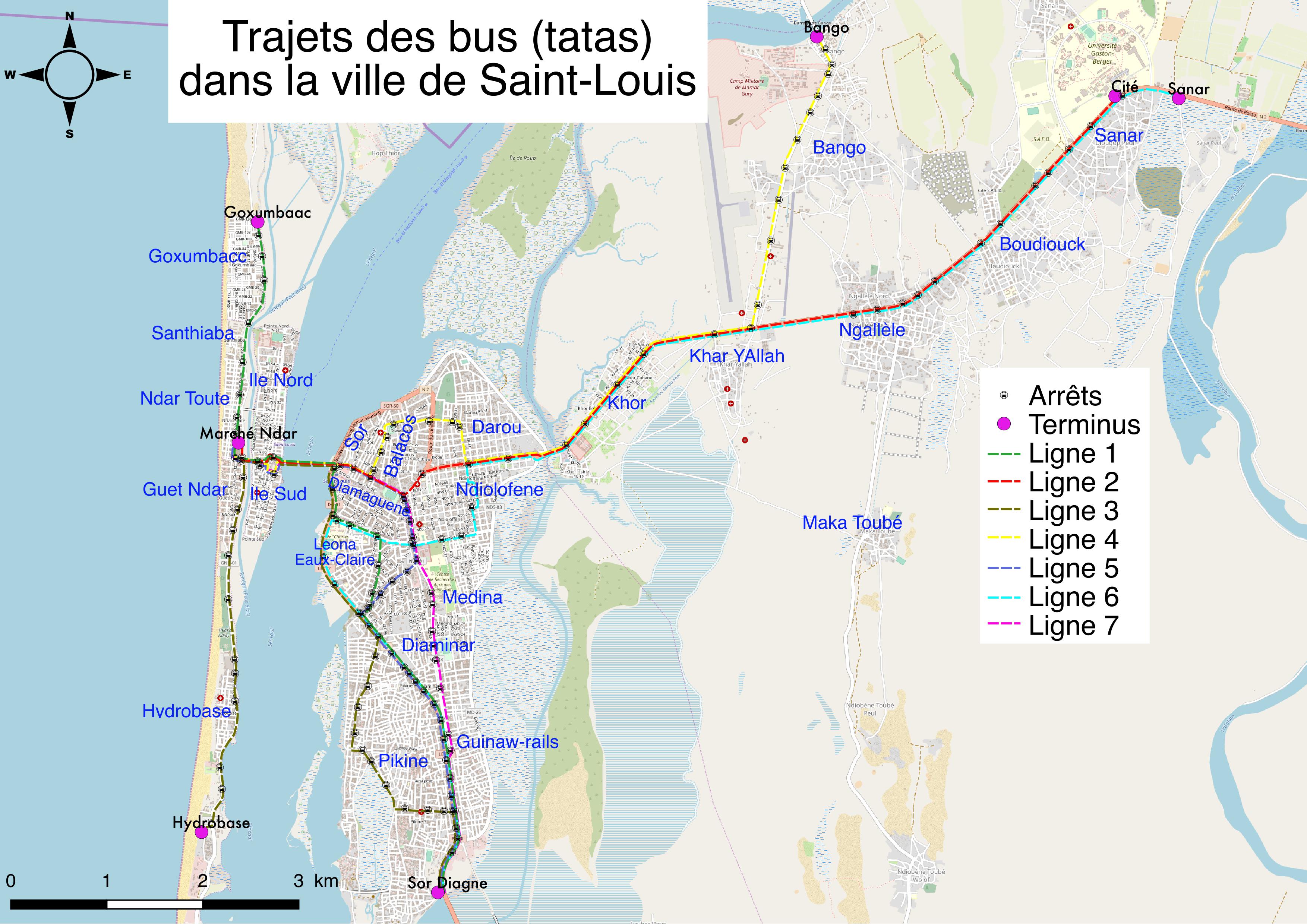
GPS field surveys on the 7 bus lines of Saint-Louis, Senegal: route mapping, stops and terminus recording. Production of 7 individual line maps and a synoptic map of the complete network. Deliverables used by the local authority for urban transport planning.
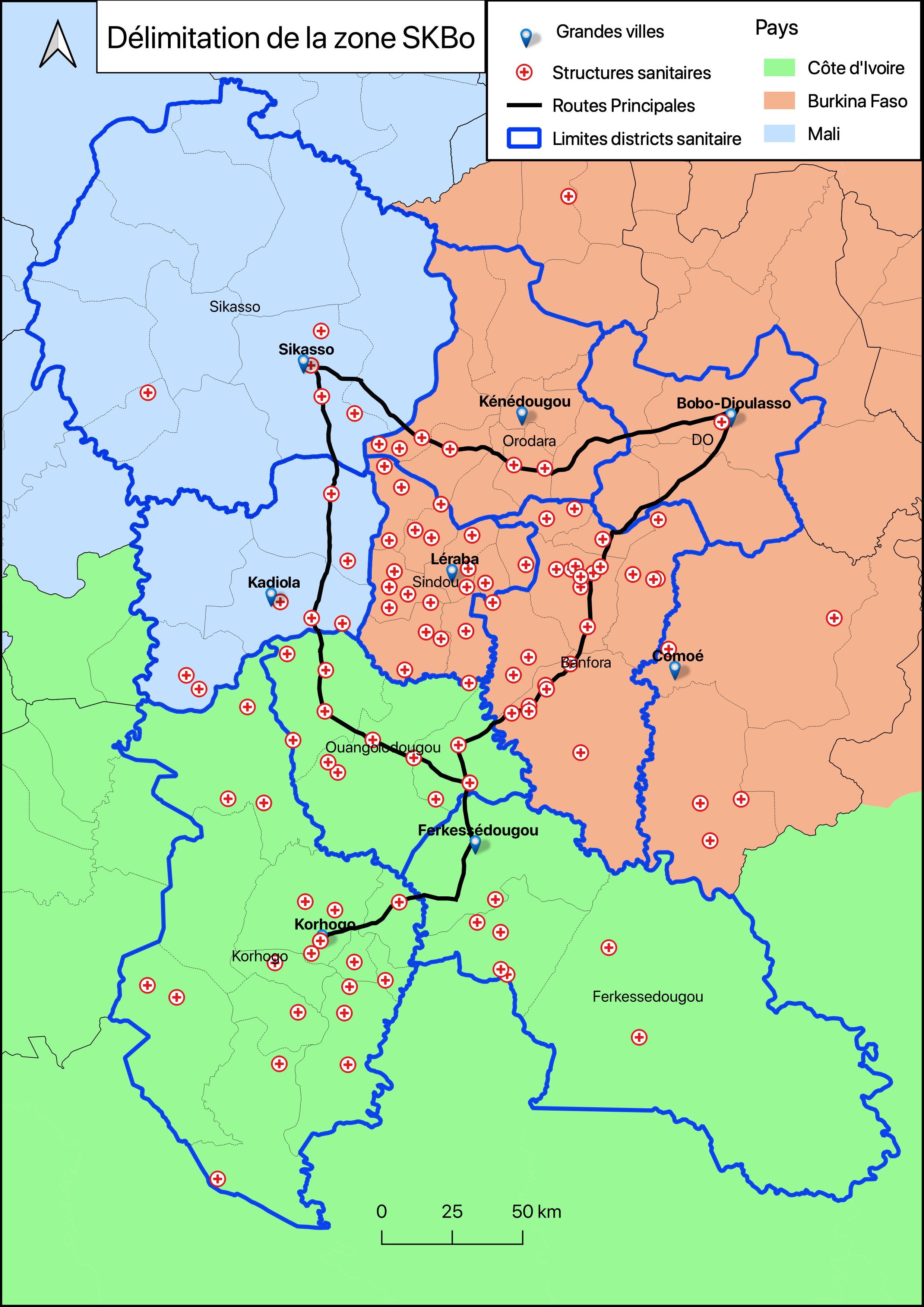
Design of Survey 123 forms for georeferenced health data field collection. Implementation of a collaborative GIS on ArcGIS Online, enabling institutional partners (NGOs, Ministry of Health, local authorities) to centralize and visualize their data in real time. Health district mapping in the SKBo cross-border zone spanning three countries: Mali (Sikasso), Burkina Faso (Hauts-Bassins, Cascades), and Côte d'Ivoire (Korhogo, Ferkessédougou). Production of approximately 15 maps for district delineation and health facility locations.
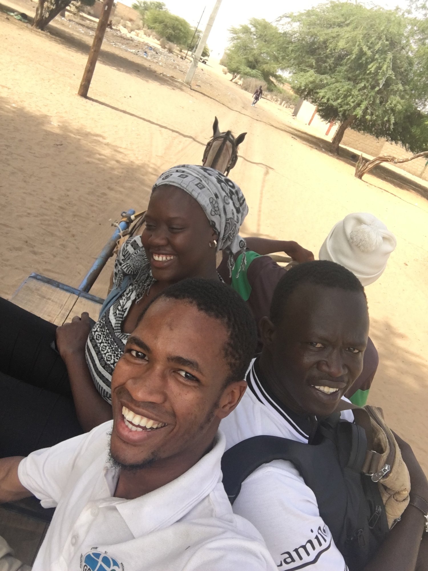
GPS and ODK Collect field survey of all health facilities in the Saint-Louis department (health posts, health centers, hospitals, pharmacies). Pilot project conducted with CartONG and OSM Senegal to feed the global Healthsites.io platform. Data cleaning, geocoding, and integration into OpenStreetMap. Results documented by CartONG and Healthsites.io.
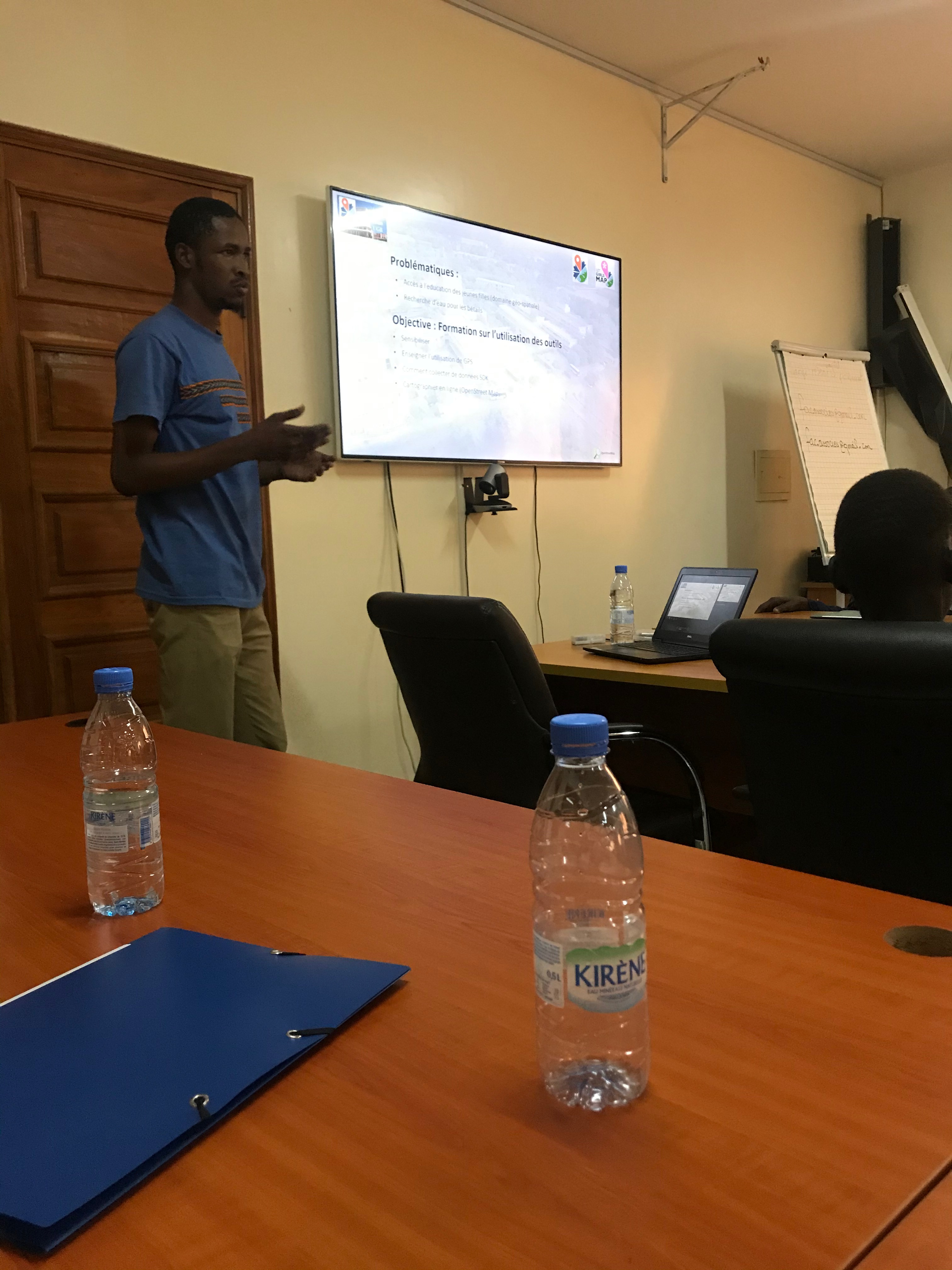
Facilitation of Missing Maps mapathons with CartONG and Montpel'Libre: logistics coordination, participant training on JOSM and iD Editor, contribution validation. Founding president of the YouthMappers club at Gaston Berger University: recruitment, student training in OSM and QGIS, and organizing participatory mapping events.
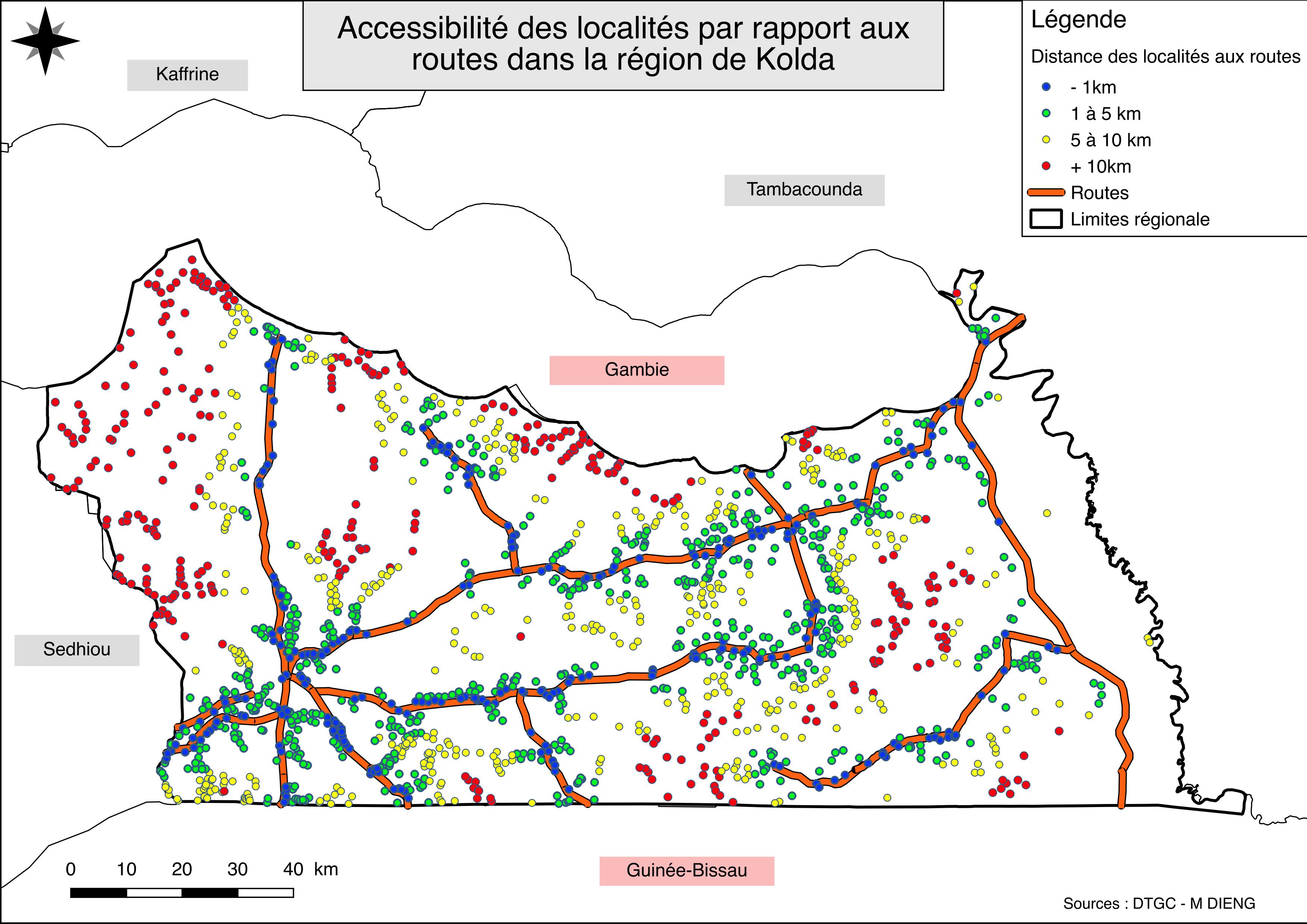
Spatial analysis of healthcare accessibility in the Kolda region (Casamance, southern Senegal). Production of 5 thematic maps: buffer zones by distance to health centers (<1km to >10km), road accessibility, multi-criteria synthesis, and zooms on critical areas. Identification of medical deserts in this rural area bordering Gambia and Guinea-Bissau.
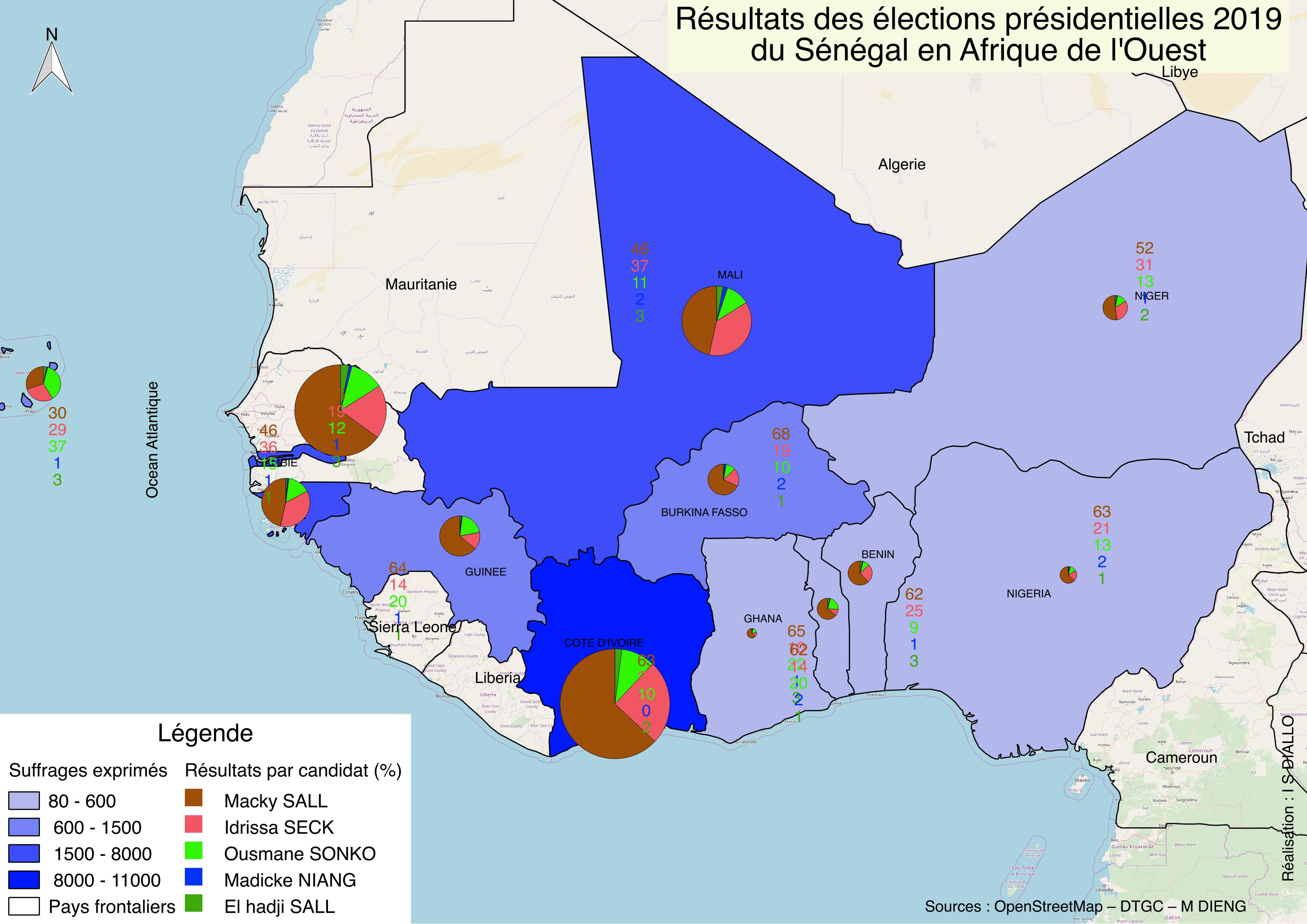
Mapping of the 2019 Senegalese presidential election results for the global diaspora. Production of 8 regional maps combining choropleth (votes cast by country) and proportional pie charts (vote distribution by candidate). Official CENA data covering Africa, Europe, the Americas, and Asia.
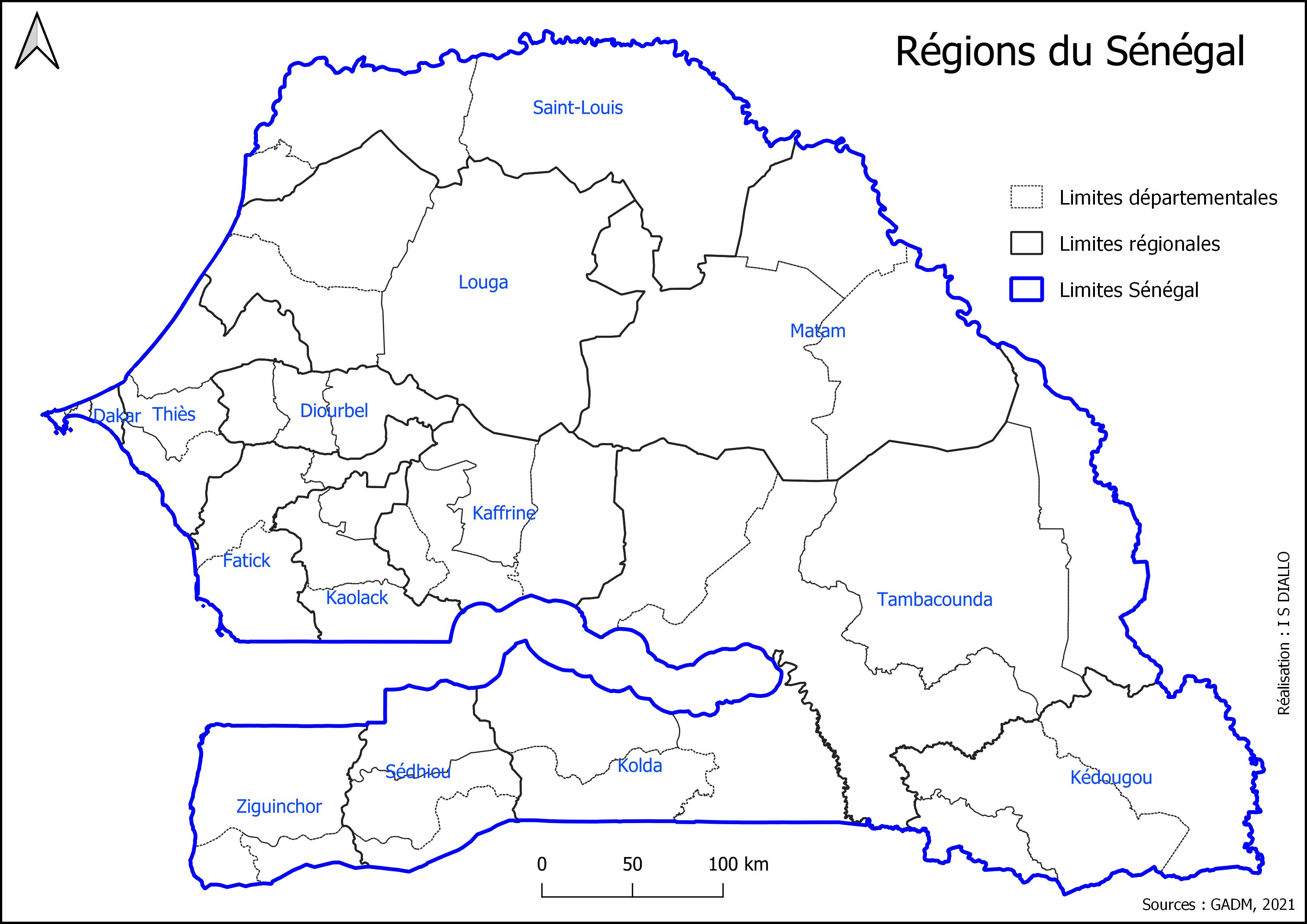
Municipal and thematic maps produced in Senegal: administrative plans for Bambey, Oussouye, Malika, Cité Niakh, and Guédiawaye department with public facility inventory (health, education, markets) and road networks. National administrative divisions of Senegal (14 regions). Mapping of an agroecological farm in Gandon/Fass Ngom with water resources and land use.
These are not client assignments: I built them on public data to show consultancies how I work as a subcontractor. Each demonstration has its own page and a PDF sheet (in French).
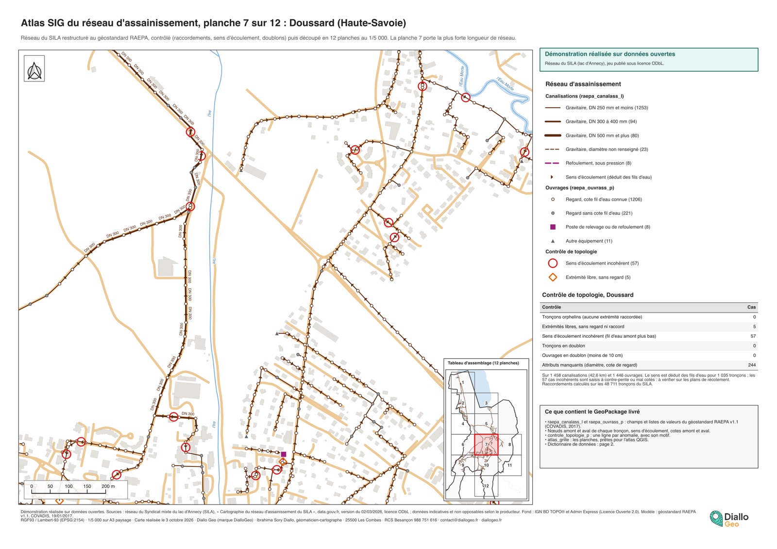
Open-data sewer network restructured to the RAEPA standard and checked in 6 points: 57 inconsistent flow directions, 244 missing attributes. A3 atlas sheet.
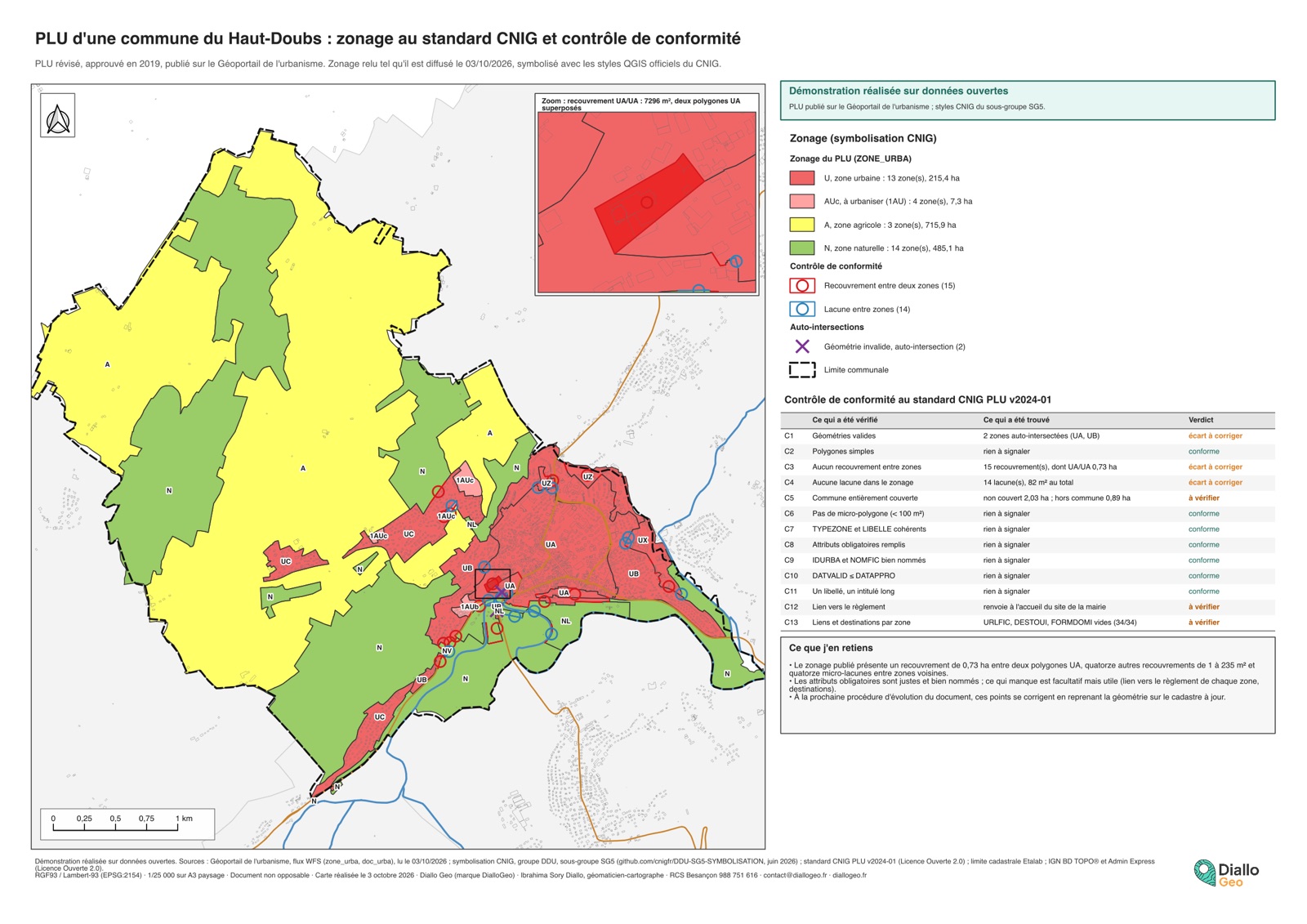
Zoning of a French local plan read from the national portal, styled with the official CNIG styles and checked against the standard in 13 points.
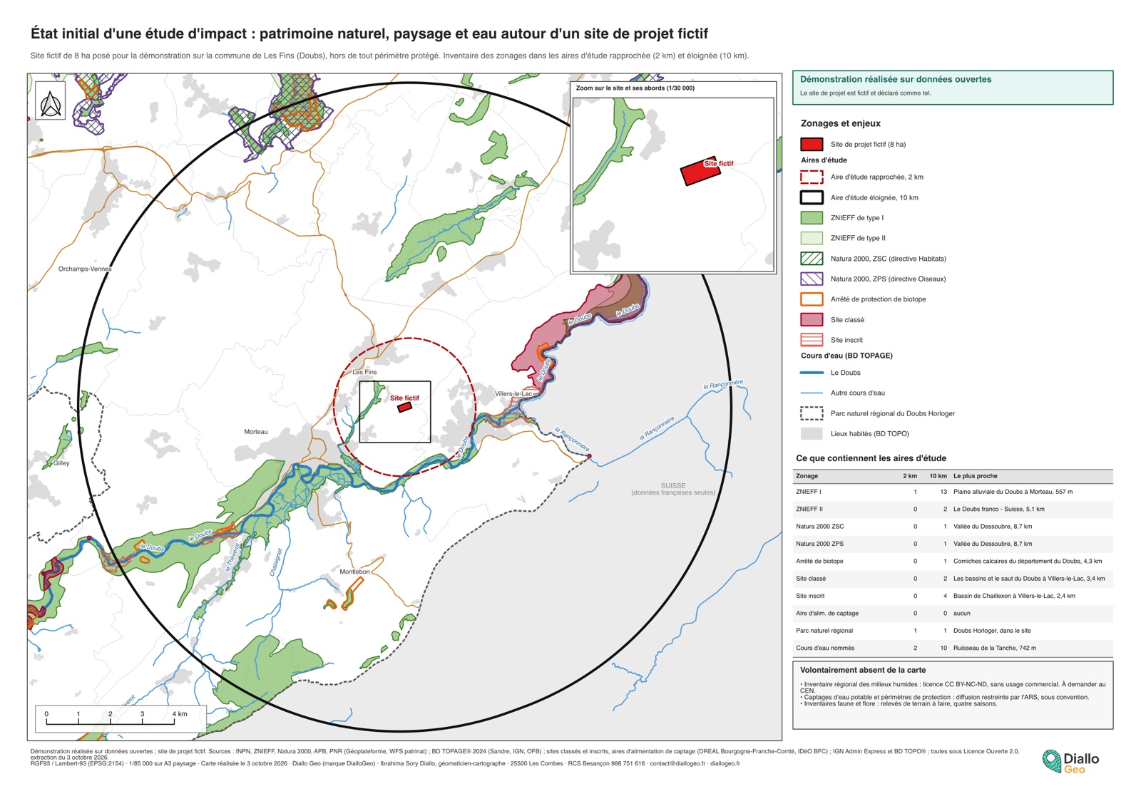
Natural and heritage designations within 2 and 10 km study areas around a fictitious project site, all sources reusable commercially.
Employers, internships and programmes, before DialloGeo was set up in April 2026. They are not clients.
FTTH, GIS for local authorities, humanitarian mapping: reply within 24 business hours, free quote within 3 business days.
Let's discuss your project →Free quote · No commitment · Reply within 24 business hours
Explore: Services offered · Profile